Pilbara Wall Map
This large wall regional map of the Pilbara and Coral Coast is ideal for discovering the northern reaches of Western Australia. The map covers the diverse marine attractions around Shark Bay, François Peron National Park and the Ningaloo Reef. It also stretches to the gorges of Karijini, lush habitats of Millstream Chichester National Park and the magnificent Marble Bar.
It also features 4WD tracks, relief shading, touring information, points of interest, facilities and distances, making it the perfect trip planning tool and reference map.
Available in two finishes at the Megamap - 1400x1307mm size.
Finish
- Laminated encapsulated - high quality produced by Hema Maps
- Photo paper; Satin 255gsm (unlaminated) - high quality produced by Hema Maps
All maps are designed and printed in Australia.
Key Features
- GPS surveyed roads and tracks
- Fuel stops
- 4WD tracks
- Camping areas
- Historic sites
Key Specifications
Edition: 9th
Publication Date: 15/04/19
Scale: 1:1,640,000
Flat size (WxH): 1400mm x 1307mm
Weight: 0.45kgs
Want something different. We do custom maps. Email: [email protected]
Product Information
Product Information
Shipping & Returns
Shipping & Returns
Pilbara Wall Map
Pilbara Wall Map
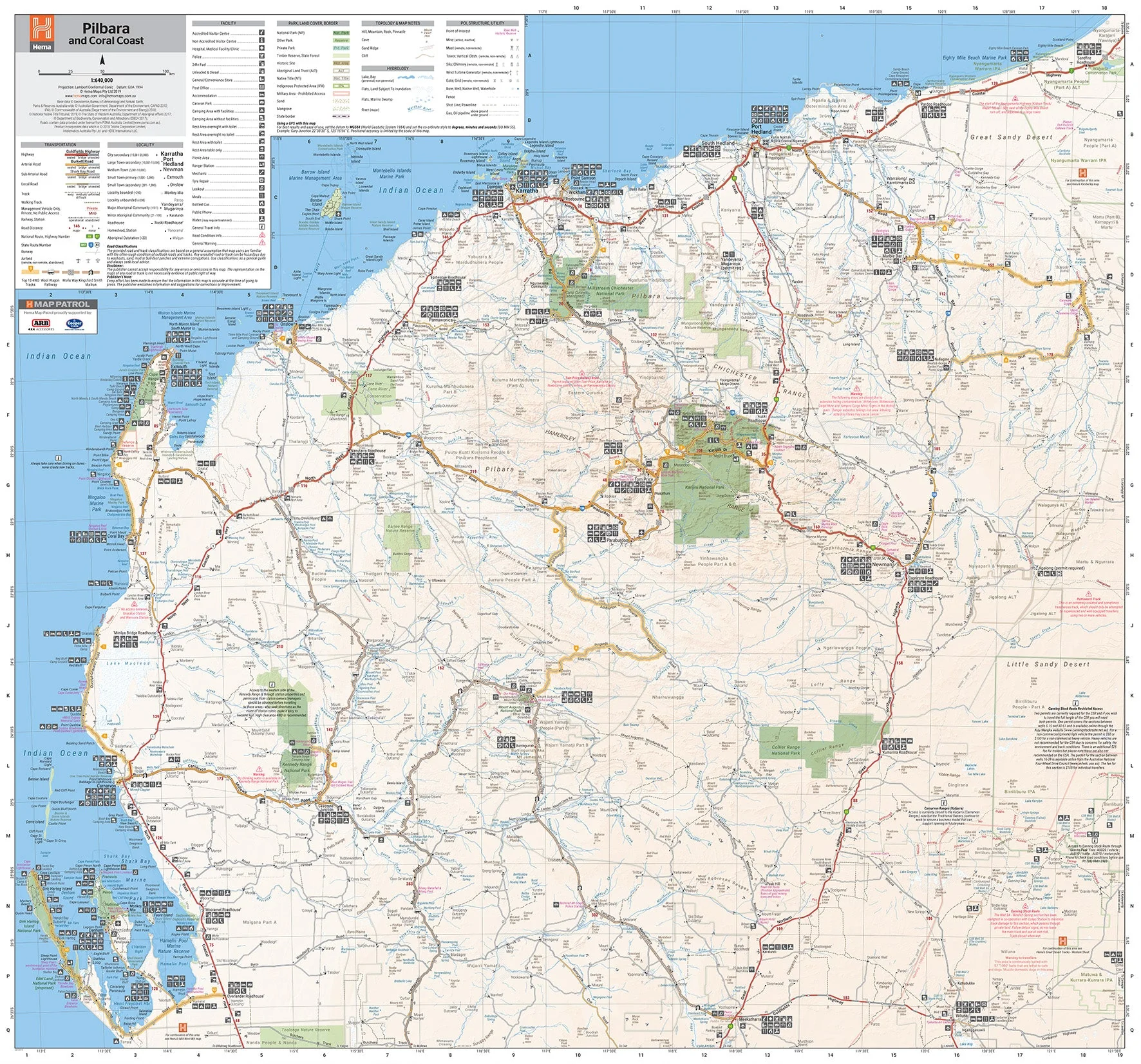
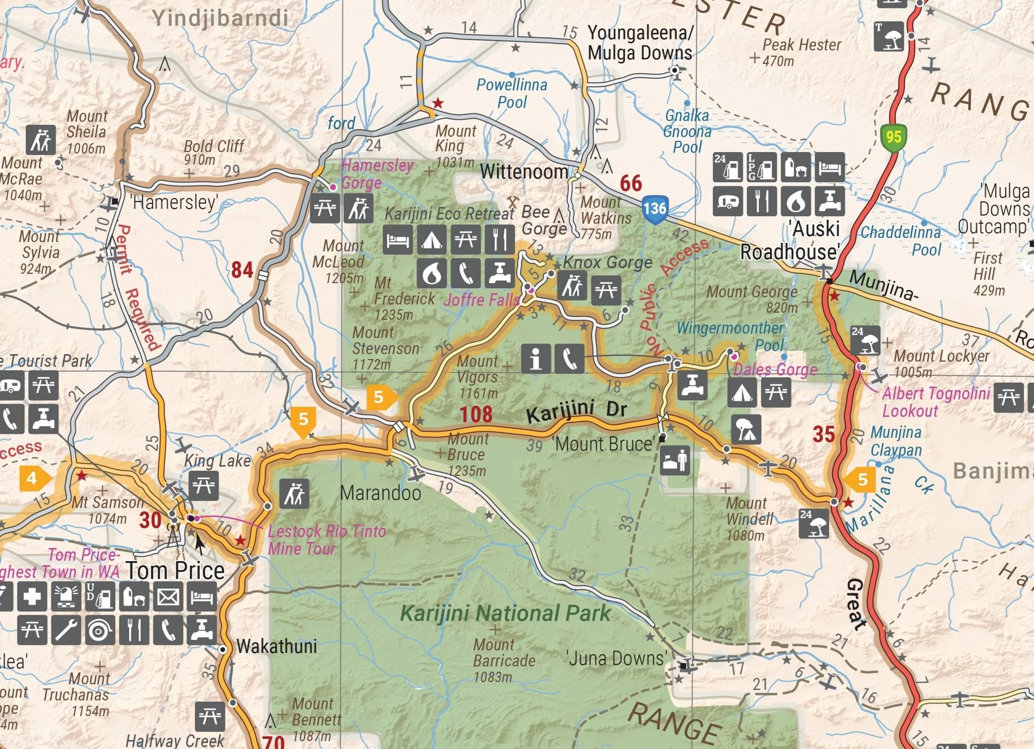
This large wall regional map of the Pilbara and Coral Coast is ideal for discovering the northern reaches of Western Australia. The map covers the diverse marine attractions around Shark Bay, François Peron National Park and the Ningaloo Reef. It also stretches to the gorges of Karijini, lush habitats of Millstream Chichester National Park and the magnificent Marble Bar.
It also features 4WD tracks, relief shading, touring information, points of interest, facilities and distances, making it the perfect trip planning tool and reference map.
Available in two finishes at the Megamap - 1400x1307mm size.
Finish
- Laminated encapsulated - high quality produced by Hema Maps
- Photo paper; Satin 255gsm (unlaminated) - high quality produced by Hema Maps
All maps are designed and printed in Australia.
Key Features
- GPS surveyed roads and tracks
- Fuel stops
- 4WD tracks
- Camping areas
- Historic sites
Key Specifications
Edition: 9th
Publication Date: 15/04/19
Scale: 1:1,640,000
Flat size (WxH): 1400mm x 1307mm
Weight: 0.45kgs
Want something different. We do custom maps. Email: [email protected]
Original: $89.20
-65%$89.20
$31.22Product Information
Product Information
Shipping & Returns
Shipping & Returns
Description
This large wall regional map of the Pilbara and Coral Coast is ideal for discovering the northern reaches of Western Australia. The map covers the diverse marine attractions around Shark Bay, François Peron National Park and the Ningaloo Reef. It also stretches to the gorges of Karijini, lush habitats of Millstream Chichester National Park and the magnificent Marble Bar.
It also features 4WD tracks, relief shading, touring information, points of interest, facilities and distances, making it the perfect trip planning tool and reference map.
Available in two finishes at the Megamap - 1400x1307mm size.
Finish
- Laminated encapsulated - high quality produced by Hema Maps
- Photo paper; Satin 255gsm (unlaminated) - high quality produced by Hema Maps
All maps are designed and printed in Australia.
Key Features
- GPS surveyed roads and tracks
- Fuel stops
- 4WD tracks
- Camping areas
- Historic sites
Key Specifications
Edition: 9th
Publication Date: 15/04/19
Scale: 1:1,640,000
Flat size (WxH): 1400mm x 1307mm
Weight: 0.45kgs
Want something different. We do custom maps. Email: [email protected]